Hackathon
Do you whant to play a game?
What if...
We use cutting edge technology to improve the weather forecast...
What if...
We buid an inundation modeling that estimates what areas will be flooded and how deep the water will reach...
Our capabilities
We are looking for problems that address topics like increased access to or use of renewable energy, mobility optimization, improvements to air quality, natural resource planning and protection, circular economy , design, and most importantly saving lives.
Some of these problems are forgotten since they are not present in the elite's or our day-today life. Humans are selfish by nature and easily forget yesterday's newspaper.
Climate change is projected to increase the frequency and intensity of extreme drought across the world. Increasing drought frequency raises concerns for agricultural productivity and development, water supply, wildfire frequency and intensity, energy production, and as well as human wellbeing.
Access and the ability to the latest data and information on climate hazards and the people vulnerable to them is critical for decision makers to mitigate risks.
However, access and the capacity to use this information is challenging as expertise in remote sensing is not widespread and data on vulnerability is difficult to obtain in a timely manner.
This leaves decision makers with information that comes too late, does not capture the full breadth of a risk analysis or is not communicated effectively to ensure its utilization.
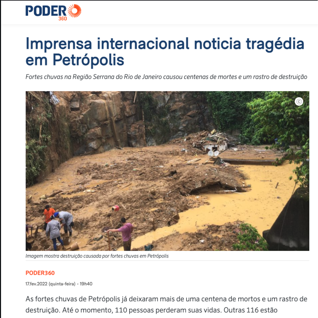
Hurb Co is commited to projects that use technology to improve Flood Forecasting in Petrópolis with the objective that NO ONE WILL NEVER DIE IN FLOOD FORECASTING due lack of technology.
Overview:
Heavy reainfall event, thunderstorms, and strong winds are forecast to impact much of northern, western, central, and southeastern Brazil through at least March 25th. The additional rainfall could exacerbate the flooding situation in areas where the ground is already saturated by previous heavy rainfall, especially in flood-hit areas of the southeast. As of March 21th, Brazil's National Institute of Meteorology (Inmet) has issued the following warnings: Red warnings for heavy rainfall: Parts of far southern Minas Gerais, western and central Rio de Janeiro, and far southeastern Sao Paulo states.
Over 6 cm (2 inches) of rain per hour or 10 cm (4 inches) of rain per day and winds of over 100 kph (62 mph) are forecast in these red warning areas. Orange warning for heavy rainfall: Acre, far southern Amapa, much of Amazonas, northern Ceara, far southern Espirito Santo, northern Maranhao, western Mato Grosso, northern and central Mato Grosso do Sul, southern Minas Gerais, central and southwestern Para, northern Piaui, northern Rio de Janeiro, far northwestern Rio Grande do Norte, Rondonia, northern and southeastern Sao Paulo, and far northern Tocantins states. Between 3-6 cm (1-2 inches) of rain per hour or 5-10 cm (2-4 inches) of rain per day and winds of 60-100 kph (37-62 mph) are forecast in these orange warning areas.
Yellow warning for heavy rainfall: Across the rest of the affected area. Officials could update and possibly extend the coverage of the relevant weather alerts over the coming days. Heavy rainfall March 20th triggered flooding and landslides in Petropolis and surrounding areas of the Fluminense Mountain Region of Rio de Janeiro State. Several landslides and flooding incidents have occurred across Petropolis, and authorities have reported five fatalities and four people missing as of early March 21th. Around 150 people have been sheltered at emergency accommodation centers across the city. Affected neighborhoods include Morin, Vila Felipe, Sargento Boening, Alto da Serra, Sao Sebastiao, and Quitandinha.
Petropolis is still recovering after severe flooding and landslied on Feb 25th which caused 233 fatalities and damaged thousands of homes across the city. Hazardous conditions Sustained heavy rainfall could trigger further flooding in low-lying communities near rivers, streams, and creeks. In developed areas with easily overwhelmed stormwater drainage systems, additional urban flooding is also possible.
Sites located downstream from large reservoirs or rivers may be subject to flash flooding after relatively short periods of intense rainfall. Landslides remain possible in hilly or mountainous areas, especially where heavy rainfall has saturated the soil. Power outages and disruptions to telecommunications services are likely where significant flooding, landslides, or strong winds impact utility networks. Transport Floodwaters and debris flows could render some bridges, rail networks, or roadways impassable, impacting overland travel in affected areas. Ponding on road surfaces could cause hazardous driving conditions on regional highways. Authorities could temporarily close some low-lying routes that become inundated by floodwaters. Severe weather could also trigger intermittent flight delays and cancellations at regional airports, though these are unlikely to be severe or prolonged. Flooding could block regional rail lines; freight and passenger train delays and cancellations are possible in areas that see heavy rainfall and track inundation.
Localized business disruptions may occur in low-lying areas. Advice Monitor local media for updated emergency and weather information. Seek updated information on weather and road conditions before driving or routing shipments through areas where severe weather is forecast. Plan accordingly for potential delivery delays if routing shipments by truck through affected areas. Do not attempt to drive through flooded areas. Confirm flights. Charge battery-powered devices in the case of prolonged electricity outages.
Important questions
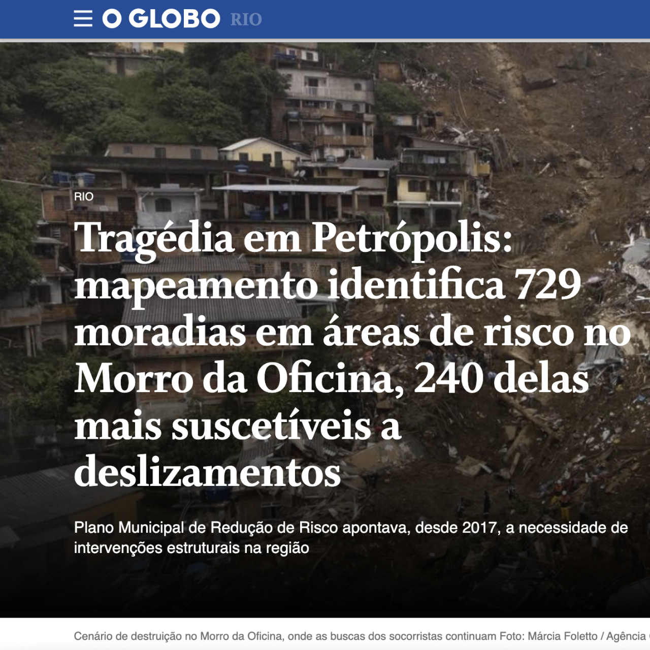
Thousands of people today live in areas at risk and that is why we urgently need an action plan to protect the entire population of the region. The challenge is to build a solution that identifies and prevents natural disasters caused by rain in Petrópolis, RJ.
We want you to work on questions like:
Heavy rain Forecasting:
Can we predict a storm surge? What is the fastest way to detect rain in mountainous regions? Can we block the rain? In the case of rain, how do we warn people about the rain and the severity of the rain?
People Evacuation"
How can we get people to a safe place and anticipate potential safety issues with everyone involved? After the rain warning, how can we direct people to the safest place?
About the challenge
At Hurb Co, we believe that AI can provide new ways of approaching problems and meaningfully improve people’s lives.
That’s why we’re excited to support organizations that are using the power of AI to address social and environmental challenges.
We looked for projects that can leverage AI to maximum efficiency in:
How fast we can anticipate the volume?
Where can not heavy rain?
Whitch parts of the region rain is a problem?
How to detect soil stability? What is the most efficient way to alert people?
What's the most effective way to find people lost?
Requirements:
Does the team have a plan to access a meaningful dataset and technical expertise to apply AI to the problem?
Have they identified the right partners and domain experts needed for implementation?
Use of AI Does the proposal apply AI technology to tackle the issue it seeks to address?
Scalability If successful, how can this project scale beyond the initial proposal?
Can it scale directly, serve as a model for other efforts, or advance the field? Responsibility Does the proposed use of artificial intelligence align with Google’s AI Principles?.
Fast forward 20 years later, we now have state of the art computation technologies. We now talk about Big Data, Artificial Intelligence, Machine Learning, Internet of Things etc. which were incubating in the realms of science fiction. With the advancements in data storage technology and reduction in costs, it is now possible to store massive amounts of data.
Seeing the changes at a more personal level contextualizes what global environmental change actually means right now and what it could mean in the future of your local community.
"EVERY MINUTE COUNTS. REAL-TIME AWARENESS MEANS ONE LIFE."
The goal here is to present a list of projects that can help you to come up with ideas, create prototypes and carry out tests during the Hackathon.
Flood Forecasting
Using better alerts can save lives in an emergency. Google Emergency Support is using AI to help.
Explore
Water Occurrence Change Intensity
The Water Occurrence Change Intensity data layer provides a measure of how surface water has changed between two epochs: 1984-1999 and 2000-2015. The layer averages the change across homologous pairs of months taken from the two epochs.
Explore
FORMA
Forest Monitoring for Action—
Rapid Identification of Pan-tropical
Deforestation Using ModerateResolution Remotely Sensed Data.
Explore
Quantifying Forest Change
The World Database on Protected Areas (WDPA) is the most up-to-date and complete source of information on protected areas, updated monthly with submissions from governments, non-governmental organizations, landowners, and communities. It is managed by the United Nations Environment Programme's World Conservation Monitoring Centre (UNEP-WCMC) with support from IUCN and its World Commission on Protected Areas (WCPA).
Explore
WDPA: World Database on Protected Areas
his tutorial provides examples of how to use Earth Engine to visualize these data, how to compute forest change over time and other statistics within a region of interest and how to download both the data and results of analyses
Explore
Global Surface Water
This dataset is described in the Nature letter High-resolution mapping of global surface water and its long-term changes. This tutorial provides examples of how to use Earth Engine to visualize data layers available in the GSW dataset, and presents some typical visualizations and analyses.
Explore
Earth Engine - Code Editor
The Earth Engine (EE) Code Editor at code.earthengine.google.com is a web-based IDE for the Earth Engine JavaScript API. Code Editor features are designed to make developing complex geospatial workflows fast and easy.
Explore
Earth Engine - tutorials
These video tutorials are from lectures or hands-on trainings conducted at Earth Engine User Summits and Earth Outreach digital events.
Explore
Earth Engine - Image Charts
The ui.Chart.image module contains a set of functions for reducing Image objects by region(s) and rendering charts from the results. The choice of function dictates the arrangement of data in the chart, i.e., what defines x- and y-axis values and what defines the series.
Explore
Earth Engine - Sentinel-1 Algorithms
Sentinel-1 is a space mission funded by the European Union and carried out by the European Space Agency (ESA) within the Copernicus Programme.
Explore
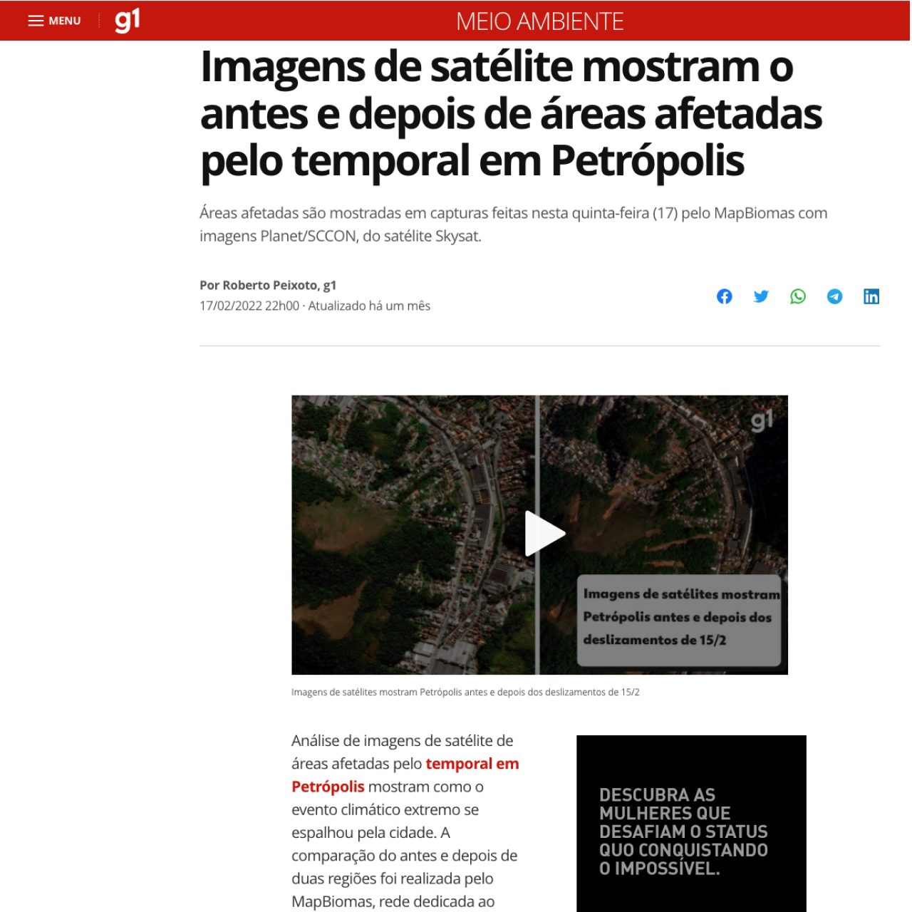
Planet.com - Gallery
Satellite photo gallery of regions by time.
Explore
Carto
CARTO is a Software as a Service cloud computing platform that provides GIS, web mapping, and spatial data science tools.
Explore
Android Emergency Location Service
In an emergency situation, your Android can’t put out a fire or restart a heart, but it can help the heroes who do those things arrive sooner. See how Android Emergency Location Service is helping you get the right help, faster.
Watch the video
Explore
ELS
ELS is a tool available on Android devices that allows first responders to locate emergency callers and texters faster and with greater accuracy, using a combination of GPS, cell, Wi-Fi and sensor data. In some regions, ELS can also provide contextualized information, such as the device language, so that first responders can act.
Explore
Form
Sounding the alarm
Using better alerts can save lives in an emergency. Google Emergency Support is using AI to help.
Explore
RLiabke
Towards Reliable Evaluation & Reporting in Reinforcement Learning.
Explore
Windy
Windt goal is to keep Windy small and fast to be accessible in the most remote locations.
Explore
Google Response - Forecasting and Alerts
Meteoblue
Today's and tonight's professional weather forecast for Rio de Janeiro. Precipitation radar, HD sarellite images, and current weather warnings, hourly temperature, chance of rain, and sunshine.
Explore


